United Kingdom - Wales, West-England - Frederik De Wit (c. 1709)
€ 600


Description
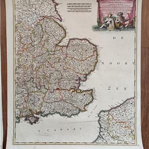
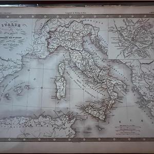
1709 Antique Map Wales & West England – Frederik De Wit – Hand Coloured
Genuine antique map of West England & Wales, engraved by Frederik de Wit and published by Pierre Mortier, Amsterdam.
Title: Occidentalior Regni Angliae, Districtus comprehendens Principatum Walliae et Glocestriae
Cartographer: Frederik de Wit
Year: c. 1709
Technical details:
Technique: Copper engraving on paper
Original hand colouring
Verso: Blank
Dimensions:
Map size: 570 × 480 mm (22.44 × 18.9 inches)
Sheet size: 630 × 530 mm – large margins
Condition: Excellent condition with strong impression and attractive original colour. Condition rating: A+ (see photos).
A highly decorative and collectible early 18th-century map, ideal for framing or collection.
Item Details
10001102
31
Antiques
30/12/2025